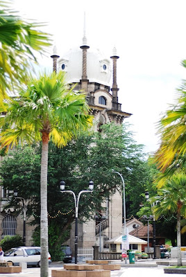
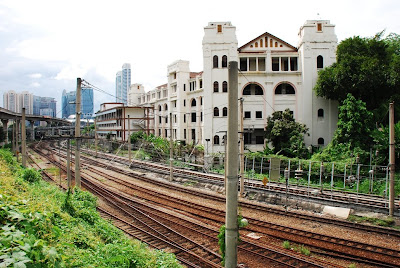
Location : Alor Setar, Kedah
GPS Coordinates : N6 07.280 E100 21.975
Alor Setar is the capital city of Kedah and famous for its nasi royale and cucur udang. If you want to taste the famous nasi royale, go to Kedai Kopi Kim Bee Chew near Pekan Rabu at coordinates N6 07.009 E100 22.017. More info at be find at
http://www.azuanzahdi.com/index.php/2009/10/31/nasi-royale-in-alor-setar/. You can also go to Hijau Kuning Restaurant at coordinates N6 06.272 E100 21.671 which is along Persiaran Sultan Abdul Hamid.
When we reached Alor Setar already evening and searching for shop houses near Jalan pekan Cina where the early chinese settlement gives the place the identity in terms of architectural design.
Traditional provision shop still operating prosperously along the street.
This pink buiding look very contrast with the traditional buidling around.
River crossing using small boats still operating along the banks near Jalan Pekan Cina to the opposite chinese temple.
High risk transportation with no safety jackets in sight.
Chinese temple along the river.
Sunset along the Kedah river.
View inside the small jetty.
Tanjung Chali tower, one of the landmark of Alor Setar. You can visit this place at coordinates N6 07.015 E100 21.749. You can see the nice view of the river banks from top of the tower.
The Alor Setar tower or known as Menara Alor Setar situated at coordinates N6 07.493 E100 22.060.
The top of the tower houses the communication equipment and a restaurant.
Yellow Palace or Istana Kuning situated beside the tower which is the place to held official royalty function.
No entrance.
Masjid Zahir situated at coordinates N6 07.208 E100 21.919 which is opposite the old Palace.
One of the important heritage landmark of Alor Setar.
The sky is very blue after the rain at night.
The morning sun brightly shine on the mosque.
The clock tower of Alor Setar.
Entrance to the Royal muzium.
The old Royal Palace.
Alor Setar Art Gallery.
State buiding of Kedah.


